
Poulton-le-Fylde is an historic market town, is situated close to Blackpool, in the district of Wyre, Lancashire and began life as a Saxon community. Its name means ‘the town by the pool’, a reference to the River Wyre at Skippool, close to Poulton. Although Poulton never had a charter, markets and fairs have been held here since medieval times. Today there is a Monday Street Market, on Market Place opposite St. Chad’s Church.
There is however, evidence of human habitation in the area around Poulton from c. 10,000 BC. In 1970, building work in nearby Carleton uncovered the 12,000-year-old skeleton of an elk, along with two bone or antler barbed points close to its hind bones. At the time of the Roman conquest of Britain in the 1st century AD, the area was inhabited by a Celtic tribe called the Setantii. A 4th-century hoard of 400 Roman coins was found in the area, near Fleetwood. Other finds have been made in Poulton and Skippool, in addition to coins, these have included a medal of Germanicus and horseshoes.
Market Cross
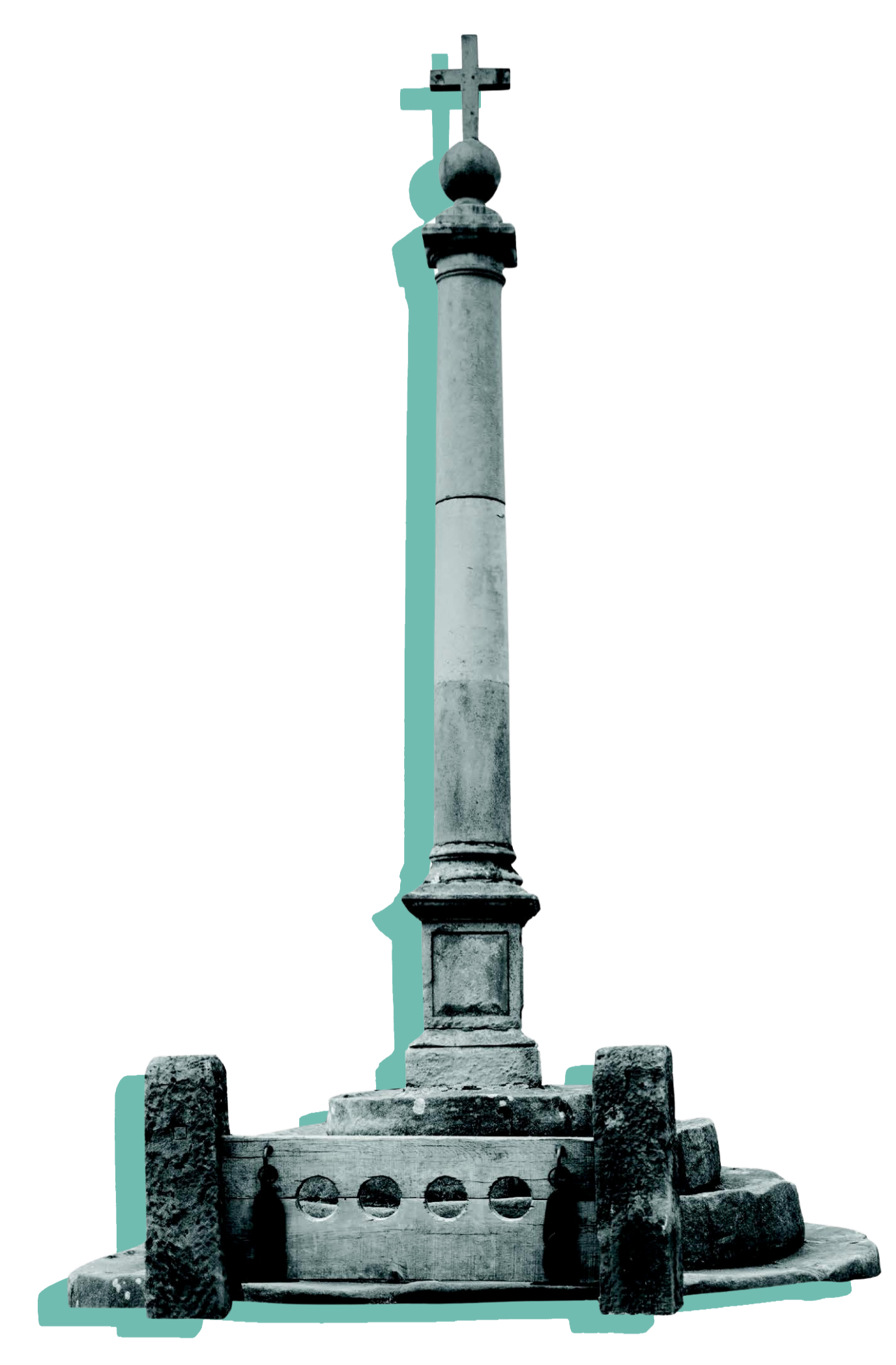
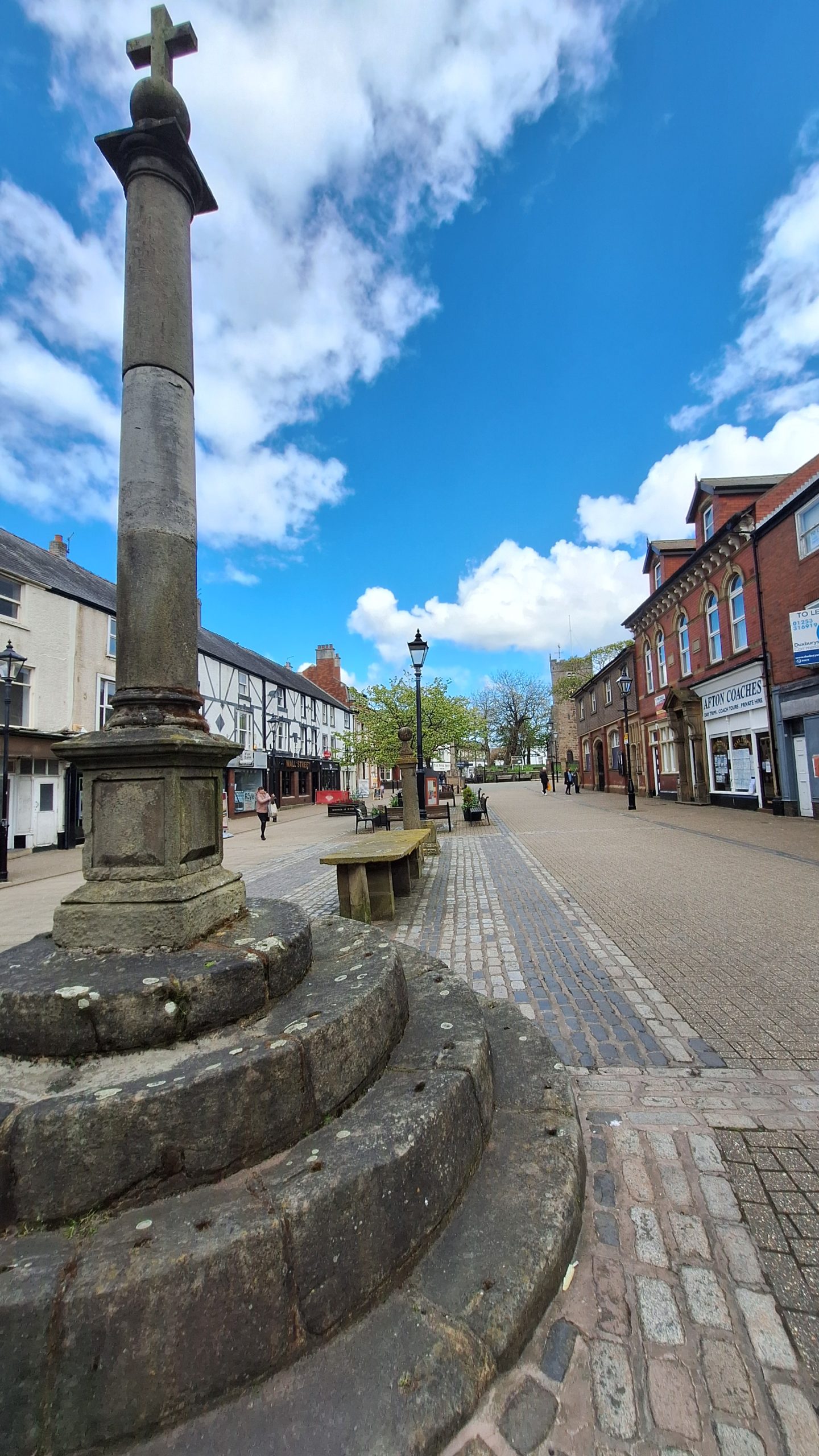
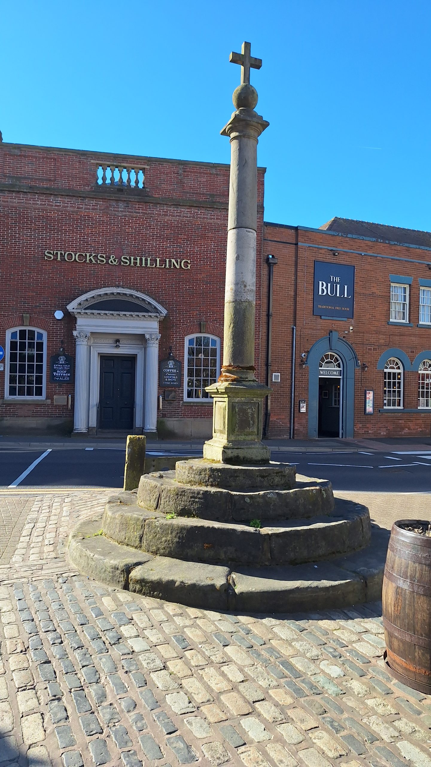
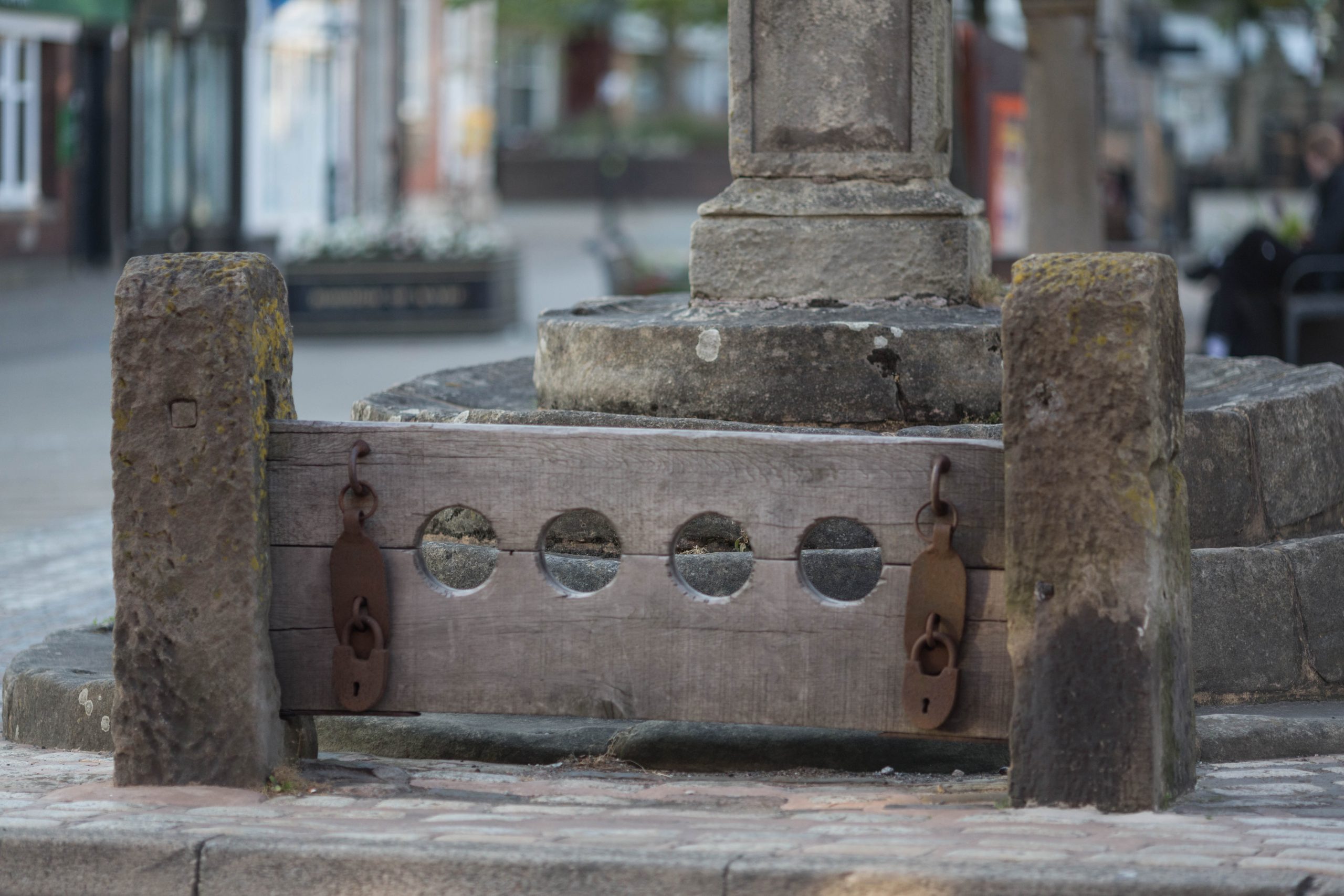
At the southern end of the Market Place you will see the Market Cross, Stocks, Whipping Post and Fish Slab. It is very rare to find such a collection of items preserved together. The whipping post and stocks were used to punish perceived wrongdoers well into the 18th Century. The stone slab was used for the sale of fish. Lodging house keepers from the new seaside town of Blackpool came here to buy produce on market days. The lamp post was erected to commemorate Queen Victoria’s Golden Jubilee in 1887.
The most prominent is the large market cross. It is similar in style to those at nearby Garstang and Churchtown. At the base are four circular steps on which the monument rests. On these is a square pedestal and a Tuscan style column rests on top of this. The whole edifice is topped off with a cross on its peak. The monument looks cobbled together from different eras, and the oldest part is tentatively dated to the 1600s.
Next to the cross are the town stocks. These have been dated to the 1700s, and certainly this kind of punishment was still in use then. They were removed in the 1930s temporarily and then subsequently reinstated. Local author, Brian Hughes, in his book The Fylde & Wyre Antiquarian, claims that in the 1970s the stocks had been hit so many times by cars that they were again removed. He suggests that the stone pillars now in place are actually farm gate posts from a nearby field. To back up his claim he publishes an Edwardian photograph in his book which shows the stocks to be taller and have square tops. The ones in place now are certainly shorter and have curved tops, but whether they are ‘new’ or merely the old ones after being repaired, we cannot say.
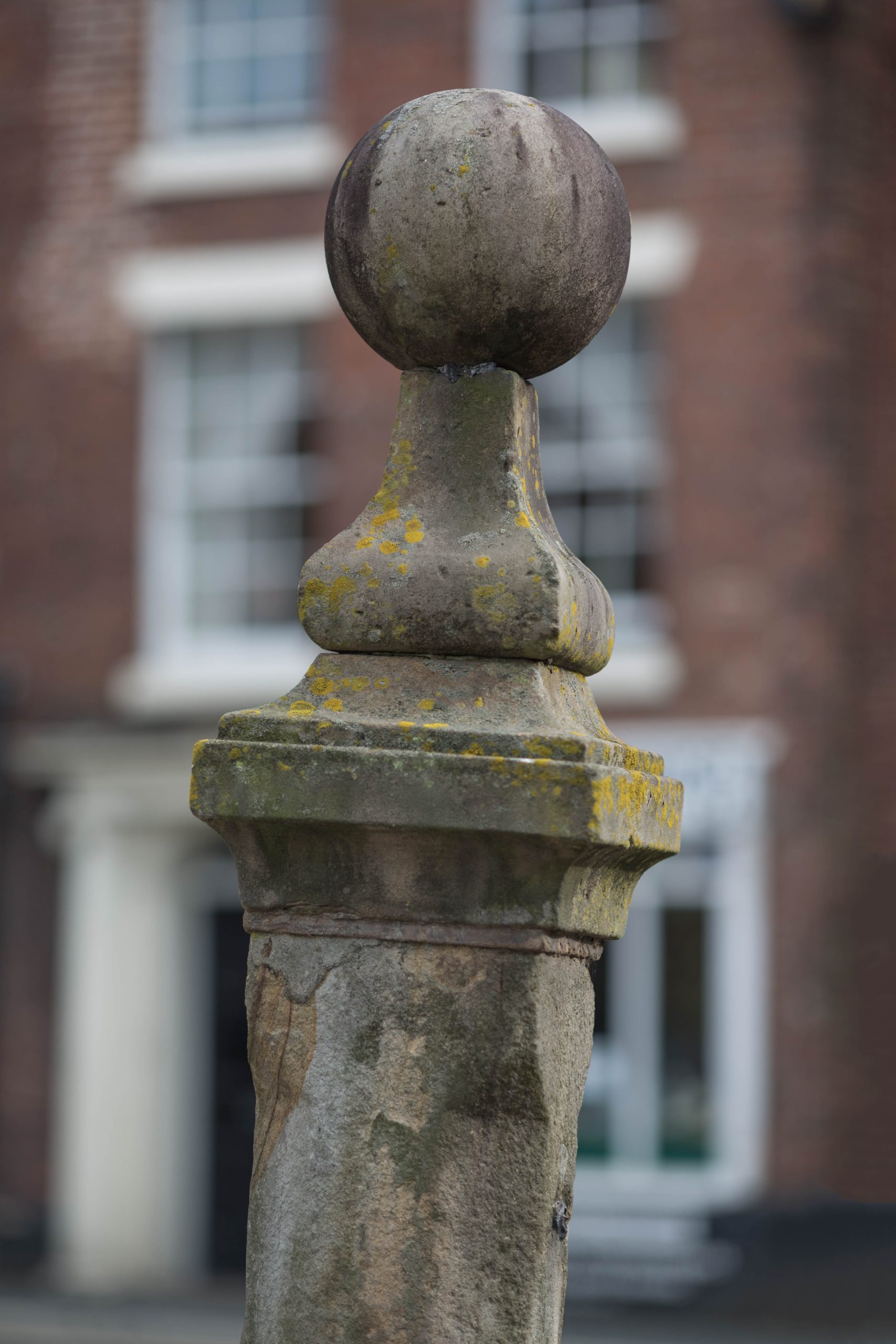
The most unusual of the curiosities is the whipping post. Possibly from the 1700s, it is a stone column with a cornice and ball finial on top. Many towns would have had one of these although most now have vanished, leaving the one at Poulton a rare survivor.
The fish stone is of an unknown date, possibly 1700s. Two flat slabs on raised legs, they are similar to the ones at Cartmel. Many northern towns used to have these, but not many are still in place. Interestingly, in contrast to these straight table-like ones, the ones at Kirkham Market are curved. Some sources claim that fish stones are where the fishmonger would lay out their fish to be sold, but others state that they were a place where deals were struck in the marketplace.
St. Chad's Church
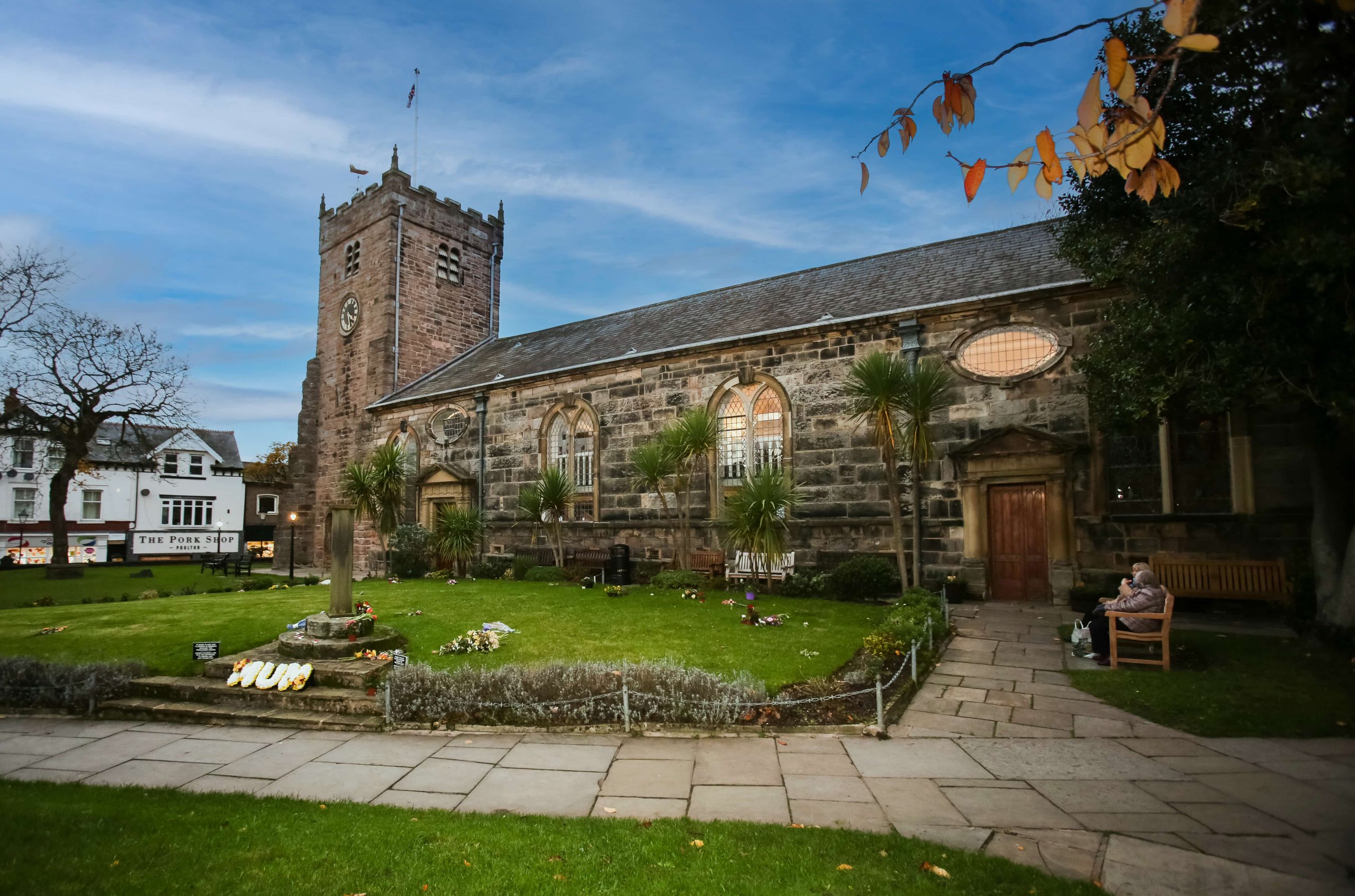
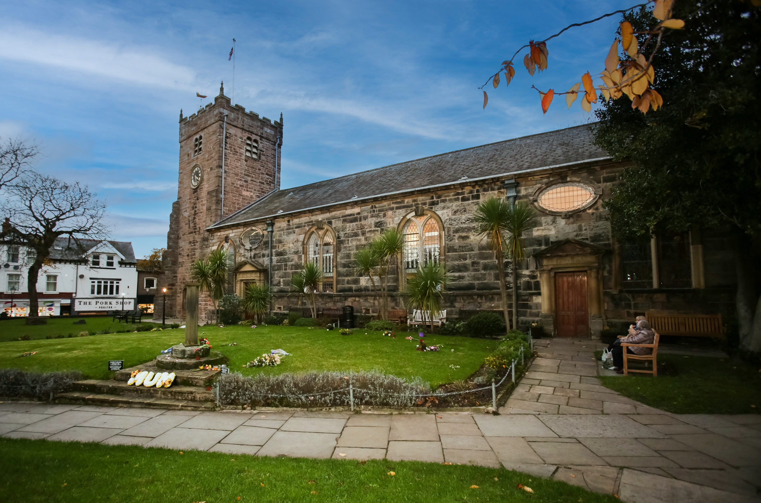
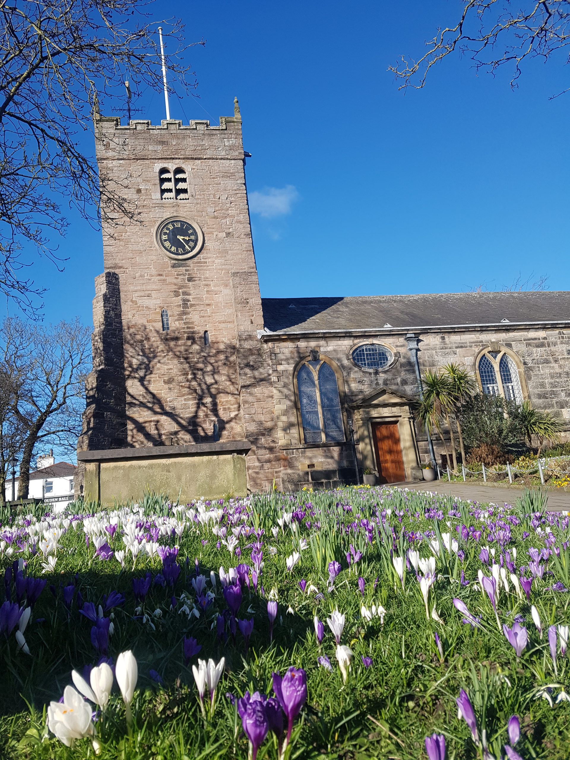
St. Chad’s Church – The earliest record of a church in Poulton dates from 1094, but it is likely that there was a Saxon church already here. The medieval building of red sandstone was re-ordered in 1752 by the present church, but research suggests that the grey stone we can see today was simply attached to the sandstone walls. The tower dates from the 1630s and the apse from 1868. Inside, the building is a marvellous example of Georgian church design, with box pews and hatchments in the galleries.
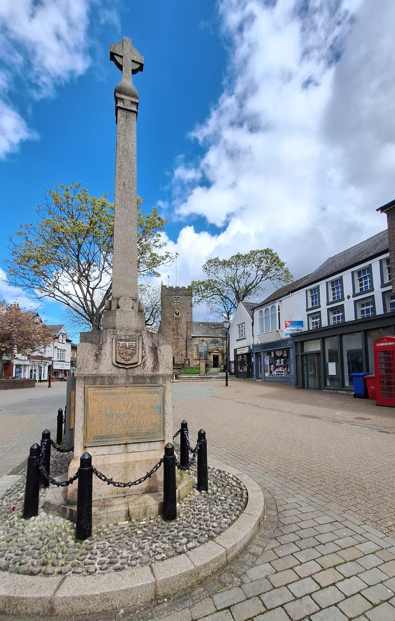
Poulton-le-Fylde War Memorial
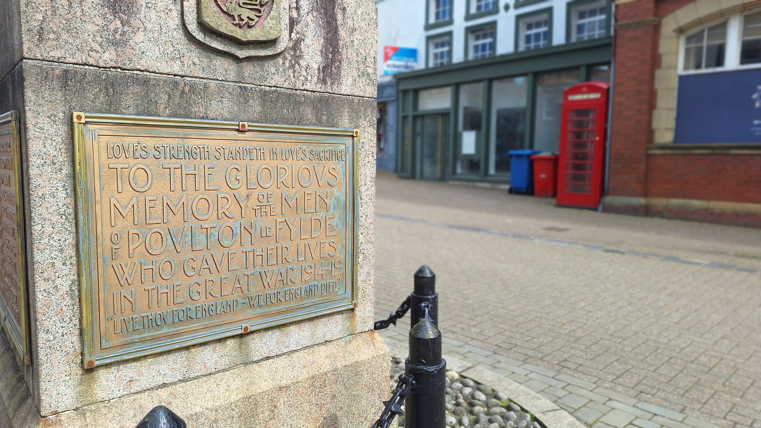
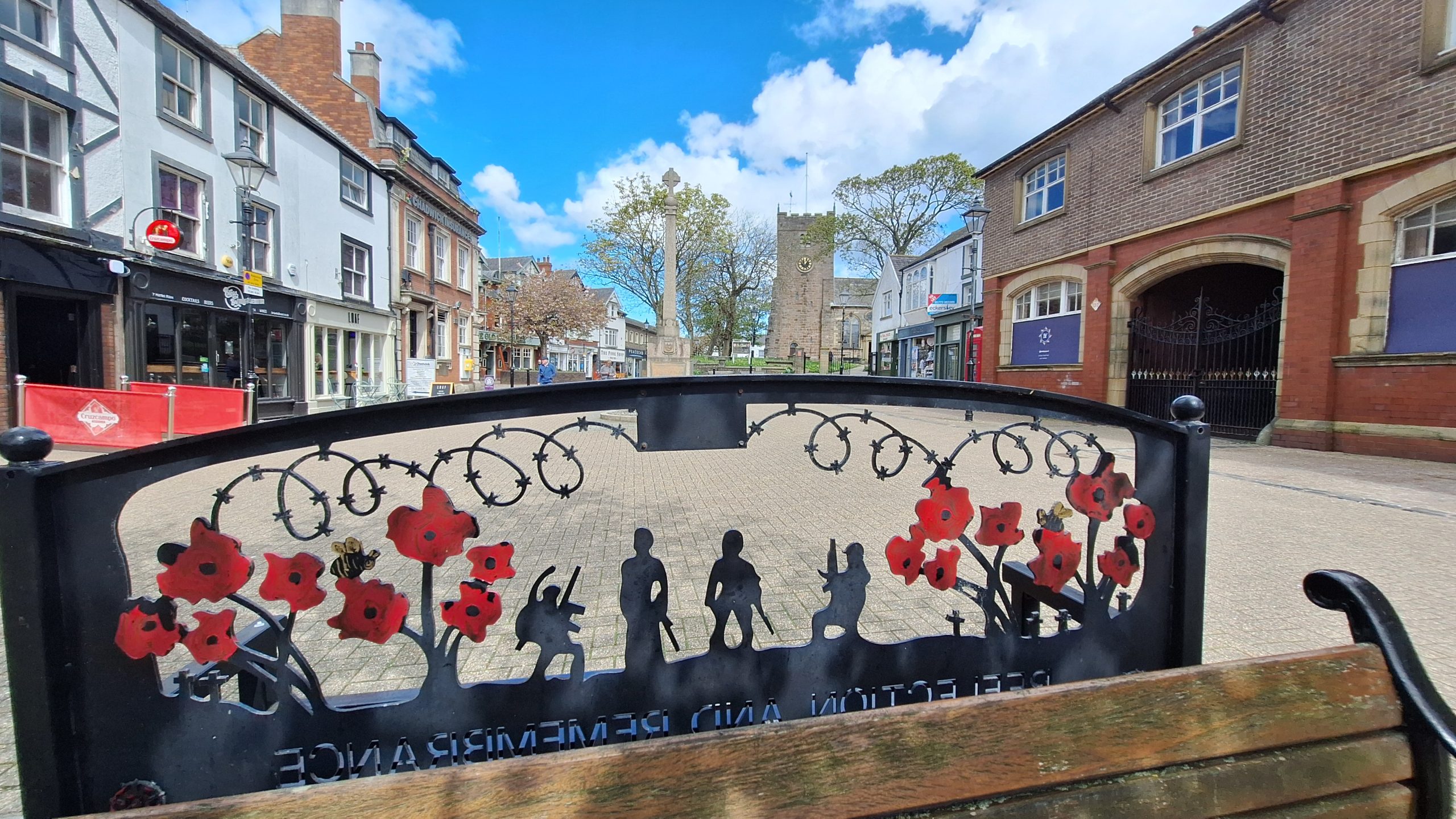
Poulton-le-Fylde War Memorial. Erected in 1921, it is located in the English market town of Poulton-le-Fylde. A Grade II Listed structure, it stands in a small cobbled area at the north end of Market Place, having been moved from nearby Queens Square in 1979. Made of granite, it consists of a pillar with an octagonal foot, and a ball finial surmounted by a wheel-head cross. The pillar is on a square plinth on an octagonal step. On the plinth is a timber plaque with a coat of arms, a bronze plaque with an inscription, and further plaques recording the names of those lost in the World Wars and another conflict.
POULTON-LE-FYLDE HISTORIC TOWN TRAIL
STEP 1

To begin the tour stand on the step of St. Chad’s Church and look out towards Market Place.
Poulton-le-Fylde is situated close to Blackpool, in the district of Wyre, Lancashire and began life as a Saxon community. Its name means ‘the town by the pool’, a reference to the River Wyre at Skippool, close to Poulton. Although Poulton never had a charter, markets and fairs have been held here since medieval times. Today there is a Monday Street Market, on Market Place opposite St. Chad’s Church.
By the early 1700’s the Market Place was surrounded by low thatched cottages and large three storey town houses built by local gentry. The streets were unpaved and there were stepping stones to keep the feet of the inhabitants out of the mud.
Near this spot stood the moot hall (town hall). In front were pent houses (sloping roofs over shop fronts giving protection from the weather) and the Shambles, a place where animals were slaughtered for meat.
STEP 2
Turn right into Church Street
The building which now houses the Pork Shop was once the Plough Inn which dated from the 18th Century. The Plough Inn was one of a dozen pubs catering for farmers and labourers coming to Poulton on market days from villages close by. Inn signs did not appear until the early 19th Century and before this beer was brewed and sold in houses. The ginnell at the side of the shop gave access to the rear of the inn.
STEP 3
Walk towards the Golden Ball pub, at the junction with Ball Street
Across the main road stands the Golden Ball, dating from the 18th Century, one of Poulton’s three coaching inns. The archway was the entrance to the stabling at the back. In the early 19th Century the pub served as the town’s reading room where copies of the national newspapers from Manchester, Liverpool and Preston were available. These ‘salons’ were usually frequented by men who talked about the national and local news and politics. The petty session court was also held here.
STEP 4
Look at the shops on the right
Look at the shops on the right of the Golden Ball and you will see that the buildings were once two fine houses. One of the original doorways still stands and serves as the entrance to the shoe repairers shop. In the mid-19th Century one of the houses was a small private school with around 30 children boarding there.
STEP 5
Looking to the left, past the car park, in the distance can be seen the original building of the independent Chapel built in 1808.
Later called the Congregational Church and then the United Reformed Church, it was restored in 1886. A new church was built in 1898 and the original chapel served as the hall. In the 2000s the 1898 chapel was turned into a set of residential apartments and the ornate frontage of the building was saved. The original chapel is now in use again.
STEP 6
Cross the road and walk past the Golden Ball and through the archway into what is now a supermarket car park.
In the late 19th Century Poulton market became so busy that the streets were crowded with animals, food stalls and shoppers. In 1896 the land at the back of the Golden Ball was developed as an Auction Mart. Attached to the brick walls at the back of the Golden Ball can still be found traces of the iron rings to which bulls would be tethered on market days. The auction mart was closed in 1969.
This is the site of an ancient Tithebarn. These were built near the parish church to hold the 1/10th of local produce which was paid by the local community towards the upkeep of the parish church. Tithes were introduced into Britain in AD 794 and the tithe system existed in some form until 1936. Before its demolition in 1969 the tithebarn was used to stage plays and hold workshops run by local craftsmen.

STEP 7
Walk carefully across the car park to the left of the supermarket building to a set of steps leading down to a path alongside the railway line. Turn right along this
path to emerge on Breck Road, opposite the railway station.
The first railway line to Poulton was opened in 1840 and the original station stood at the bottom of Breck Road on the corner of Station Road. The present station was built in 1894 and had one of the longest platforms in England. It has won a number of competitions for its appearance under the care of the Friends Group. Notice the LYR in the stone lintel next to the main door, denoting the Lancashire and Yorkshire railway.
Look down Breck Road, which slopes away from you, and notice the large Victorian family houses built in the 1880s by wealthy business people. A back street runs behind the houses on the left and the outbuildings now used as garages were originally built as stabling for the houses. The name ‘Breck’ is probably derived from the Old Norse meaning ‘slope’.
STEP 8
Walk back up Breck Road, heading toward the Thatched House pub.
On the corner of Breck Road and Vicarage Road is a red brick building, the former Conservative Club, which is now a bar. Until 1929 this was the Ship Inn, which accounts for the sailing ships to be seen in the brickwork high up on the walls. The white building on the left was the birthplace of William Thornber, a noted local historian. Born in 1803, William later became the Vicar of St. John’s Parish Church, Blackpool. His parents, Giles and Elizabeth are buried nearby in a large tomb in the north east corner of St. Chad’s Churchyard.
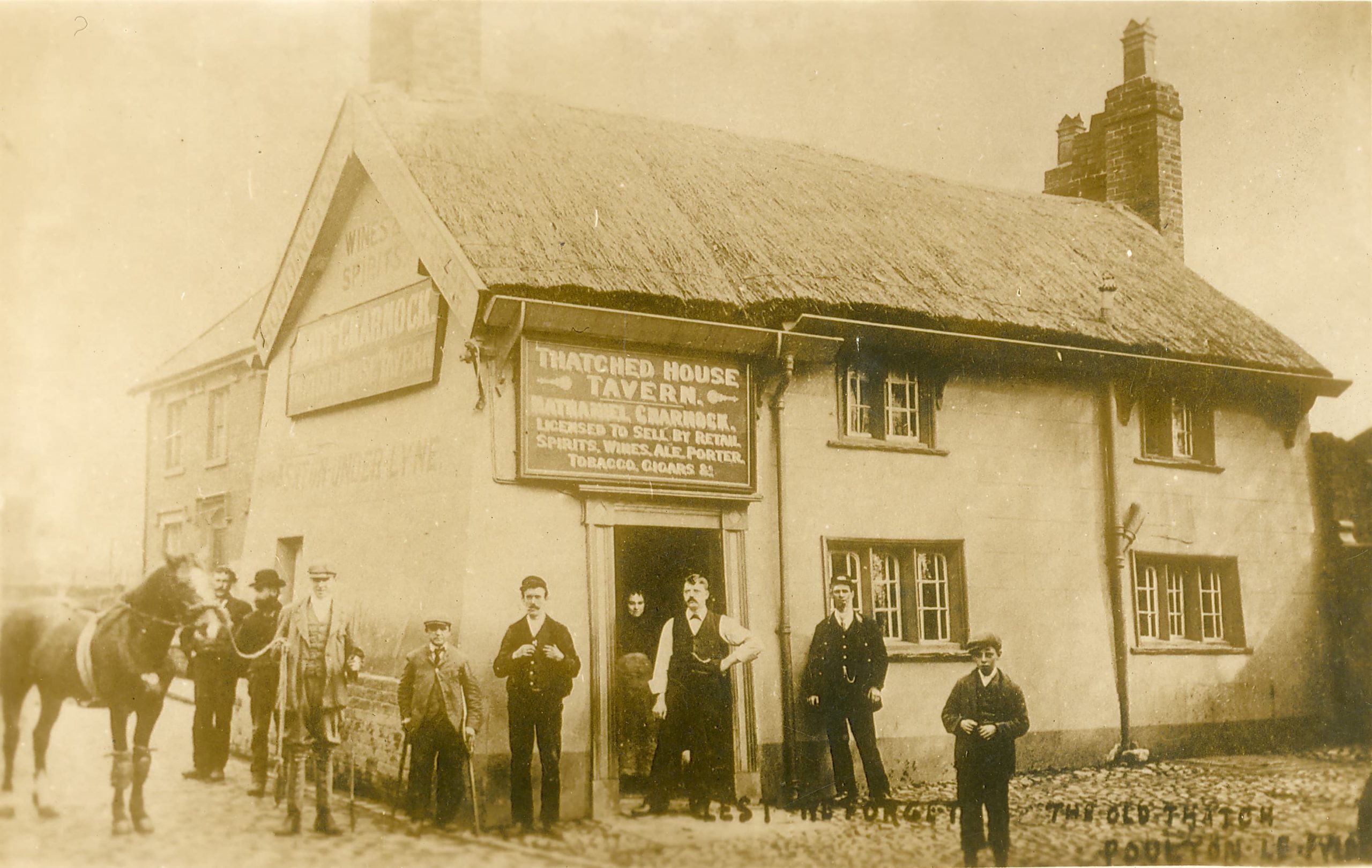
Photo Credit: Reproduced with the permission of the Archives Service Manager Lancashire Archives
STEP 9
Look across Vicarage Road to a fine detached house on the corner of Chapel Street.
This was built as the town Savings Bank in 1839, the date marked by a plaque high on the end wall, by the end of the 19th Century the building was also in use as a lending library.
STEP 10
Turn left at the junction to walk a little way along Vicarage Road.
On your left is Poulton’s original cinema, the Rialto, built in 1917 and now a restaurant. Opposite stands the Poulton-le-Fylde Community Hall which today holds a varied programme of events throughout the year. Built in 1925 as a church hall, the building both internally and externally is a fine example of Arts and Crafts architecture. At the far end of Vicarage Road is a children’s play area, Vicarage Park, more commonly known by locals as Jean Stansfield Park, named after a little girl who died in the 1930’s aged 8 years. The land for the park was gifted to the town by her parents.
STEP 11
Return to the junction of Breck Road and Ball Street.
In the corner of the church yard is a pub and microbrewery. The Thatched House was erected in 1910 and stands close by to St. Chad’s Church. It replaced an ancient cruck built inn which stood at right angles to this one. Parishioners often had long distances to travel to attend church, therefore pubs were often built next to churches to provide refreshments. It is likely that the original pub on this site was called The Green Man.
STEP 12
Walk down Chapel Street past the Thatched House and turn right into Chapel Street Court, a walkway lined with small shops and cafes.
This was once the notorious Potts Alley with a lodging house and cottages backing onto the churchyard, and a running drain down the centre. The inhabitants of these cottages were reprimanded in the 1840s for emptying their chamber pots from their back bedroom windows into the graveyard. Walk to the Market Place end of the old wall, and look closely at the old brickwork and you will see the original front door steps of these houses.
STEP 13
Walk to the end of Chapel Street Court and turn left into Market Place.
At the southern end of the Market Place you will see the Market Cross, Stocks, Whipping Post and Fish Slab. It is very rare to find such a collection of items preserved together. The whipping post and stocks were used to punish perceived wrongdoers well into the 18th Century. The stone slab was used for the sale of fish. Lodging house keepers from the new seaside town of Blackpool came here to buy produce on market days. The lamp post was erected to commemorate Queen Victoria’s Golden Jubilee in 1887.
On the west side of the Market Place stands a long terrace of shops. The original thatched medieval cottages which once stood here were destroyed in a fire in 1732, which caused damage estimated at £1032. The money for rebuilding was raised by national appeal. The fire was caused by sparks from a lighted taper being carried in a funeral procession.
Facing away from St. Chad’s Church you will notice a row of three buildings overlooking the Stocks. The Bull on the right was one of Poulton’s three coaching inns, but now has a modern frontage.
The pub, next to The Bull, now known as The Stock and Shilling, was formerly a bank. This building replaced a fine three storey town house built in 1692 by Sir Alexander Rigby of Layton Hall.
Next to the pub is an 18th century 3-storey house formerly owned by James Baines. He was a woollen merchant who lent money to local inhabitants rather as building societies do today. James Baines left money to endow three local charity schools so boys from less wealthy families could be educated for free. He also funded apprenticeships so they would have training and work upon leaving school. His house has been little altered on the outside and is a good example of Georgian handmade brickwork. The James Baines charity still exists today.
STEP 14
Turn left out of Market Place and into Queen’s Square.
The three storey building on the left was Poulton’s third coaching inn, the Spread Eagle. A little further on, the frieze depicting the four seasons over the archway is a reminder of the Corn Mill which stood behind this building until the late 1960s. The oldest remaining cobble stones in Poulton can be seen in this passageway which led to a bakehouse and jam factory in the 19th Century.
Looking across Queen’s Square the building at the corner of Hardhorn Road was built as Poulton’s Institute in the early 1900’s to provide activities and educational classes for the young people of the town. From the 1930’s it was the local library until the present one on Blackpool Old Road was built in 1965.
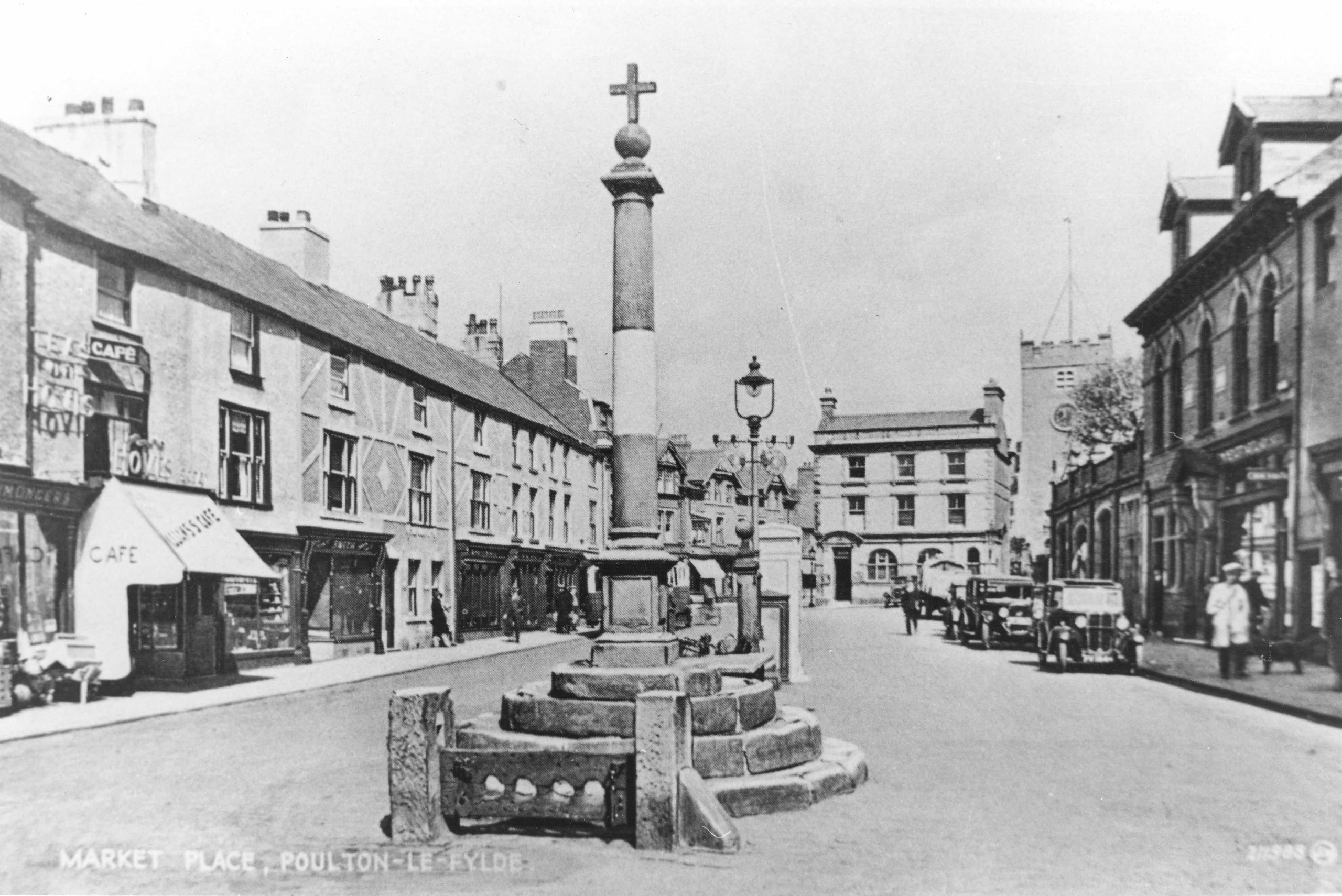
Photo Credit: Reproduced with the permission of the Archives Service Manager Lancashire Archives
STEP 15
Cross Queen’s Square and walk a little way down Hardhorn Road.
Hardhorn Road was once known as Wheatsheaf Street, named so after a pub which stood here. In the 1730s a bakery stood in the terrace of cottages on the left of the street and on the right hand side on the corner of Wheatsheaf Way was the house of Samuel Lomas a well-known clock maker in the 18th century. He was responsible for repairing the church clock and some examples of the clocks he made can still be found in local family homes.
STEP 16
Walk from Queen Square and head to the corner of Chapel Street.
Chapel Street was named after the Wesleyan Chapel built here in 1819 and demolished in 1965. The present Methodist Church stands on Queensway. On the opposite corner is a terrace of small cottages typical of those found in 18th Century Poulton. The road leading away from Queen’s Square is known as Higher Green, and further on becomes Lower Green. It is likely that Poulton’s common grazing land was nearby in medieval times.
STEP 17
Walk back up Chapel Street to the entrance of St. Chad’s Churchyard and walk up the diagonal path to take a look at the historic parish church.
The earliest record of a church in Poulton dates from 1094, but it is likely that there was a Saxon church already here. The medieval building of red sandstone was re-ordered in 1752 by the present church, but research suggests that the grey stone we can see today was simply attached to the sandstone walls. The tower dates from the 1630s and the apse from 1868. Inside, the building is a marvellous example of Georgian church design, with box pews and hatchments in the galleries.
Extend your visit - the Skippool to Stanah Heritage Trail
If you’d like to make a day of it, why not extend your visit with the Skippool to Stanah Heritage Trail? This fascinating riverside walk can be started from either Skippool Creek or Wyre Estuary Country Park at Stanah, and follows the banks of the River Wyre through some of the most historically rich landscape in the borough.
Along the way you’ll pass smugglers’ haunts, a Victorian mansion, ancient trading docks used since Roman times, and the sweeping saltmarshes of the Wyre Estuary , a Site of Special Scientific Interest and the largest area of ungrazed saltmarsh in Lancashire. Whether you’re a history enthusiast, a birdwatcher, or simply looking for a rewarding walk with spectacular views across to the Bowland Fells, this trail has something for everyone.

Explore items relating to Poulton-le-Fylde from the collection
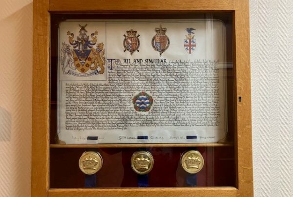
Grant of Arms to the Borough of Wyre 1975
Grant of Arms to the Borough of Wyre 1975
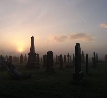
The Cemeteries of Wyre
The Cemeteries of Wyre
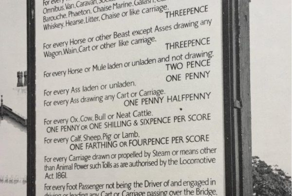
The Tolls for the Old Shard Bridge
The Tolls for the Old Shard Bridge
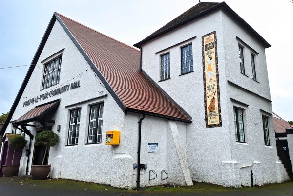
Poulton Community Hall
Poulton Community Hall
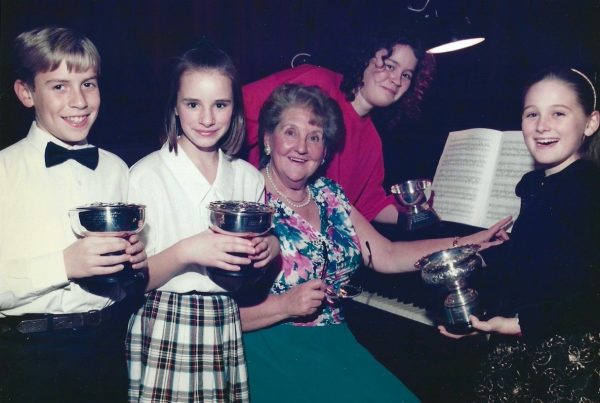
Pioneering women of the 20th Century
Pioneering women of the 20th Century
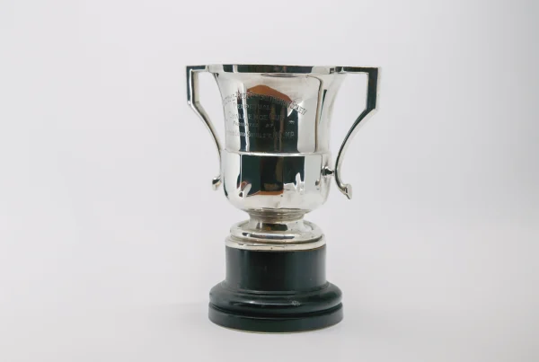
Poulton-le-Fylde Chrysanthemum and Horticulture Perpetual Cup
Poulton-le-Fylde Chrysanthemum and Horticulture Perpetual Cup
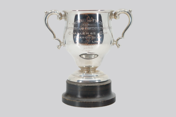
Poulton-le- Fylde Chrysanthemum and Horticulture Society Challenge Cup
Poulton-le- Fylde Chrysanthemum and Horticulture Society Challenge Cup
Wyre Council
Civic Centre, Breck Road, Poulton-le-Fylde, Lancashire, FY6 7PU
Email:
heritage@wyre.gov.uk